Geotechnics in Linear Infrastructures: From Risk to Sustainable Value Creation
Linear infrastructure, such as highways, railways, pipelines, transmission lines, and logistics corridors, represents the backbone of economic and social development. More than just transportation and energy assets, they are catalysts for competitiveness and territorial integration.
However, their scale and location in heterogeneous geological and geotechnical environments pose significant challenges. Often invisible in the early design stages, these factors become crucial for safety, resilience, and total cost of ownership throughout the project's lifespan.
In this context, geotechnics is not just a support discipline, but a strategic axis of viability.
The strategic role of geotechnics
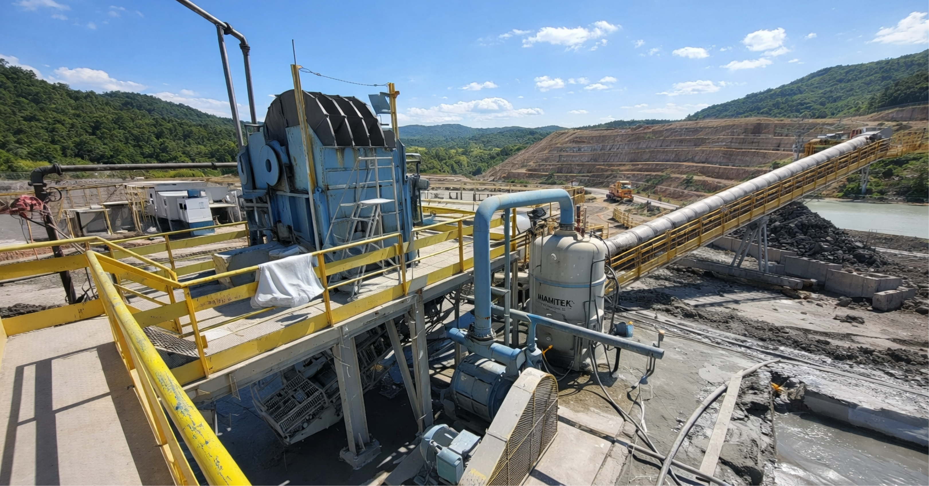
Geotechnics applied to linear works involves mapping and anticipating critical subsoil and surface conditions, correctly characterizing the subsoil, evaluating and determining slope stability, hydrogeological modeling, and continuous monitoring.
When these factors are not addressed with technical robustness, they can become operational bottlenecks and financial risks. Therefore, they become key elements in anticipating risk scenarios and guiding critical decisions.
Importance of characterization and modeling
Global companies already recognize that investments in geotechnical characterization and modeling during the design phase reduce corrective maintenance costs by up to 40%, in addition to extending the useful life of infrastructure.
The logic is clear: greater analytical effort upfront means less exposure to unexpected risks and costs down the road.
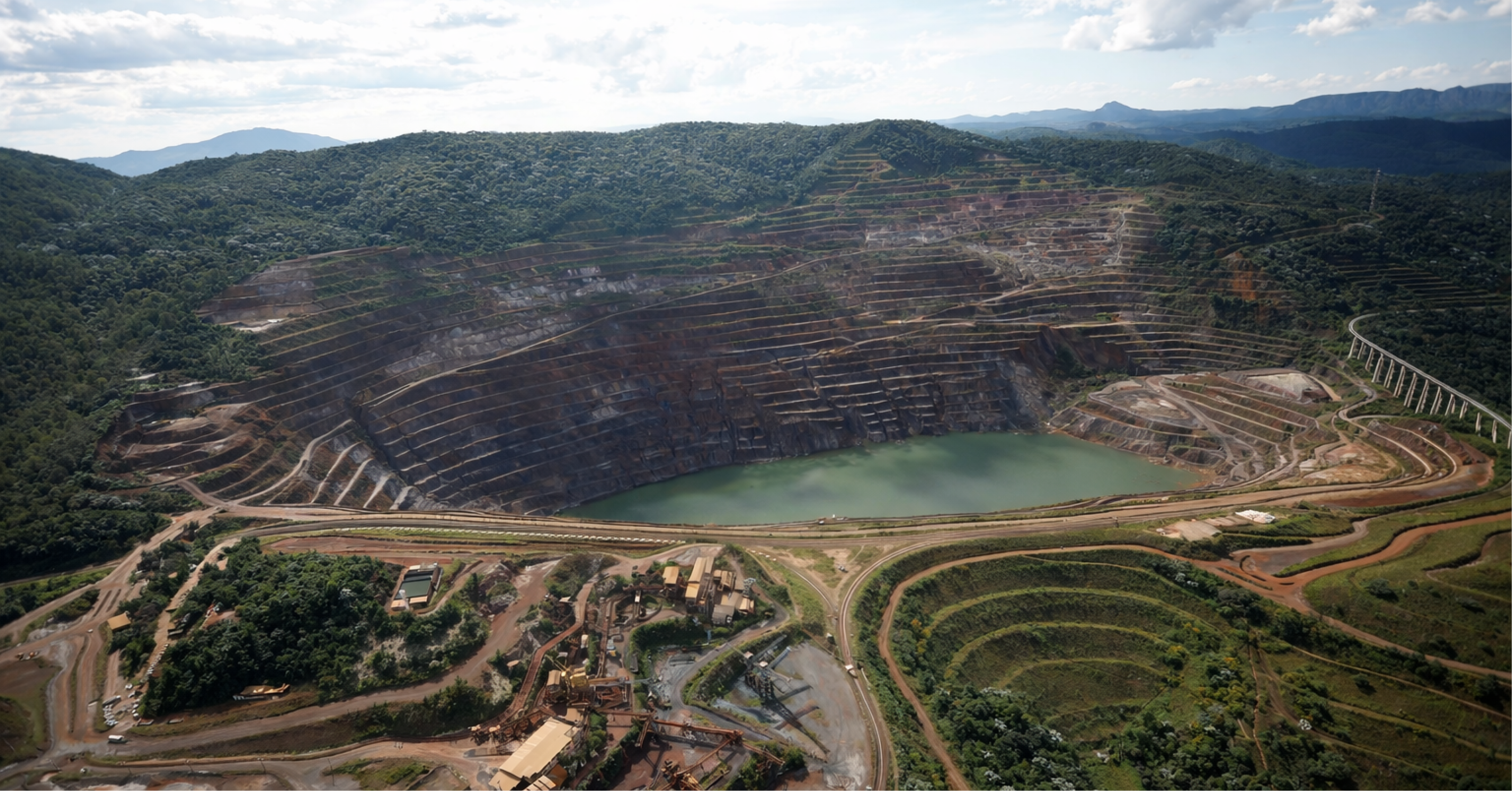
The Geotechnical Risk Map
A central tool in this process is the Geotechnical Risk Map, based on a probability and impact matrix.
It shows that low-frequency, high-impact events—such as the failure of a major slope—can be as critical as recurring, smaller-scale failures, such as surface erosion in drainage systems. This prioritization guides more efficient technical solutions and provides managers with clarity on where to allocate resources.
From risk management to building resilience
Linear infrastructure is particularly vulnerable to disruptive events, such as extreme rainfall or localized mass movements. In these cases, quantitative risk assessment, aligned with international standards such as ISO 31000 and guidelines from public bodies, becomes fundamental.
ALARP Panel
THE ALARP (As Low As Reasonably Practicable) Panel classifies risks into green (tolerable), yellow (optimizable), and red (intolerable) zones. This approach facilitates communication between engineers, regulators, and society, enabling clear and transparent management.
The concept of resilience
The concept of resilience expands the perspective beyond prevention. It reinforces the need to design systems capable of withstanding failures, but also adapting and even strengthening in the face of new climate patterns and socioeconomic pressures.
Resilience Radar
To measure this performance, one can use the Resilience Radar, which evaluates projects along five axes:
- Technical robustness
- Adaptive capacity
- Monitoring efficiency
- Socio-environmental integration
- Risk governance
This vision reinforces the integration between technology, innovation and governance.
Integrated governance and life cycle
Another critical aspect is the governance of geotechnical risks. Linear infrastructures traverse different jurisdictions, cross watersheds, and impact diverse communities. In this scenario, integrated stakeholder management, strict compliance with environmental conditions, and transparency in decision-making are inseparable from technical performance.
Integration throughout the life cycle
Geotechnical engineering only reaches its full potential when incorporated throughout the entire project lifecycle. From route planning, through conceptual and executive design, to construction, operation, and adaptive maintenance, geotechnical knowledge must serve as a guiding principle.
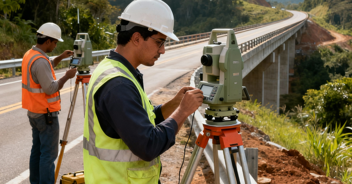
Real-time monitoring
THE Infrastructure Life Cycle with Geotechnical Integration demonstrates this continuity. Each stage feeds the next with technical and risk information.
The use of real-time remote monitoring—with piezometers and inclinometers—strengthens technical governance and builds stakeholder confidence. Cutting-edge international projects already use dynamic dashboards that allow for near-immediate responses, increasing the safety and credibility of projects.
From risk mitigation to value creation
When structured consistently, the relationship between geotechnical engineering, risk, and safety transcends regulatory boundaries. It becomes a lever for value and a competitive differentiator.
Projects that incorporate advanced practices reduce delays, lower unforeseen costs, increase operational availability, and gain social legitimacy.
The three deliveries of geotechnics
In an integrated manner, geotechnics applied to linear infrastructures provides:
- Economic efficiency, reducing unforeseen expenses and optimizing assets.
- Operational safety, with mitigation of failures and accidents.
- Sustainability and social license, balancing technical performance and environmental impacts.
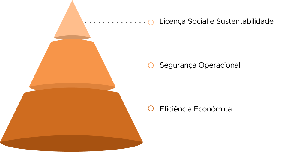
The value pyramid
This concept can be seen in the Pyramid of Value in Geotechnics:
- At the base is economic efficiency, which reduces maintenance costs and optimizes the life cycle.
- At the intermediate level, operational security, which ensures regulatory compliance and risk mitigation.
- At the top, sustainability and social license, which strengthen reputation and competitiveness.
The role of VinQ Geotecnia
In the VinQ Geotechnics, we believe that the future of linear infrastructures depends on the integration of science, engineering and governance into cohesive, robust and strategic solutions.
Our purpose is to transform geotechnical uncertainties into actionable knowledge, converting invisible risks into safer, more resilient, and competitive projects.
More than analysis, we seek to deliver strategic value. Our work enables clients to view geotechnical engineering as a pillar of trust, differentiation, and longevity in projects that connect territories and shape societies.
Authors:

Matheus Vicentini
Civil Engineer (Unilavras), Specialist in Geotechnical Engineering (PUC Minas).
Civil Engineer with experience in geotechnics applied to mining, with experience in projects, audits and dam decommissioning works.

Leandro Azevedo da Silva
Bachelor in Geology (UFRRJ), Master in Mining Engineering (UFMG) and Specialist in Mineral Resources Engineering.
A geologist with nearly 20 years of experience in geotechnics, he leads technical projects at VINQ, combining innovation and safety in mining solutions.

John Paul dos Santos
Bachelor in Mining Engineering (UFMG), Master in Civil Engineering and Management (University of Glasgow), Specialist in Geotechnical Engineering and Project Management.
Mining Engineer specializing in geotechnics and project management, an international reference in dams and geotechnical structures applied to mining.