
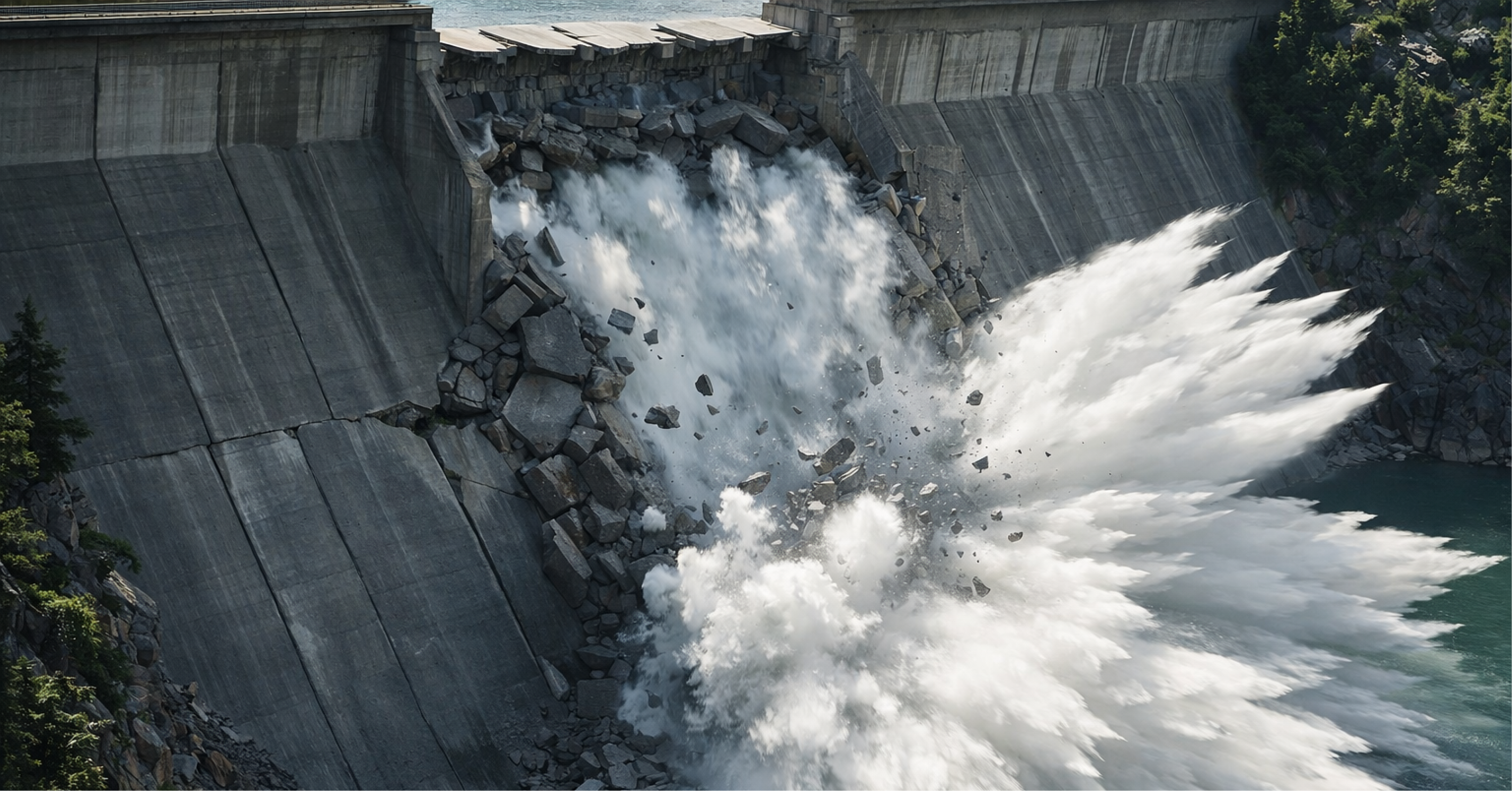
Internal erosion and piping in mining structures: early signs and responses.

A treacherous mechanism and the loss of the intervention window.
Internal erosion and piping remain among the most insidious failure mechanisms in mining structures because they combine well-established physics with discrete early signals, high operational ambiguity, and non-linear acceleration dynamics. The problem rarely arises as a single, obvious "alarm." It forms as a convergence of small deviations, for example, a new seepage that "appears normal," turbidity that doesn't reach zero, a piezometry that rises and doesn't return, or drainage that loses efficiency. In environments where water, fines, constructive heterogeneity, and frequent changes in geometry coexist, this convergence is more likely than is admitted. The consequence is well-known: when the organization realizes that it wasn't just an operational variation, the window for intervention has already narrowed.
Internal erosion, piping, and the triangle of necessary conditions.
From a technical point of view, internal erosion is the progressive dragging of particles from the soil mass or foundation by the action of water flow. Piping is the advanced expression of the same process, that is, an erosive conduit that grows, concentrates flows, increases gradients, and can culminate in subsidence, turbid seepage, and loss of integrity. The logic is simple and, precisely for that reason, operationally powerful: the risk increases when three conditions coexist. First, there is sufficient hydraulic energy, translated into high load, gradients, and pore pressures. Second, there is susceptible material, frequently associated with a particle size distribution that allows migration of fines, poorly compacted zones, segregation, interfaces with fragile transitions, or ineffective filters. Third, there is a preferential percolation path, typically associated with cracks, contacts with rigid structures, conduits, foundation-embankment interfaces, abutments, and regions of material and construction variation. The practical recommendation is to treat this mechanism as a triangle of necessary conditions. If two sides are already present, the priority should increase. When all three appear, the response is not "monitor more." The response is to reduce hydraulic load and control the flow path before the process becomes self-sustaining.
Why does the mechanism deceive the operation?
The reason this mechanism “deceives” the operation is not the lack of instrumentation, but the way signals are interpreted and converted into decisions. In many assets, the data exists, but there is no decision-making system. The organization collects numbers, but does not operate triggers. It attributes turbidity to rain, flow to seasonality, and piezometers to instrument instability, without testing the adverse hypothesis. This generates a dangerous pattern: weak signals are normalized, which postpones the only intervention that truly changes the risk in the short term, which is water control. In piping, the difference between a “near miss” and an event is usually less about the existence of a preferred path and more about the speed and discipline with which the company transforms clues into actions with low regret.
Internal erosion as a system, not as a list of measurements.
Therefore, a robust internal erosion program needs to be structured as a system, not as a list of measurements. This system combines four complementary layers. The first is disciplined field inspection, with defined routes, mechanism-oriented checklists, comparable photos, traceability, and clear authority to escalate severity. The second is hypothesis-driven instrumentation, focused on variables that capture regime change, such as piezometry, flows in drainages and springs, turbidity, and, when applicable, hydrogeochemical signals such as conductivity and temperature, which help infer the origin of the flow. The third is integration and context, with correlation between rainfall, levels, disposal rates, geometric changes, recent interventions, and availability of drainage and pumping systems. The fourth, and often the most neglected, is a trigger level architecture with predefined responses. Without triggers, monitoring becomes observation. With triggers, monitoring becomes risk management.
Early signs that indicate a change in regimen.
The most useful early warning signs are those that indicate a change in flow regime, not just high values. In the hydraulic domain, this translates to increased flow that is decoupled from rainfall, new or laterally migrating springs, persistent turbidity, and the presence of fines in drained water. An important point is that reduced flow in designed drains can be as concerning as increased flow, as it may indicate clogging and the transfer of hydraulic load to undesigned pathways. In the geotechnical and geometric domain, signs include localized settlements, subsidence, sinkholes, cracks that evolve over time, and incremental deformations that correlate with hydraulic changes. In the operational domain, the risk increases when the asset fails to consistently maintain target levels, when there are recurring pumping and drawdown failures, when "temporary routes" of water become permanent, and when interventions are repeated at the same point without a root cause diagnosis. The recurring blind spot is treating each sign as an isolated event. Internal erosion typically manifests as convergence: small deviations that, when viewed together, indicate that the necessary conditions are forming.
Both unexpected increases and decreases in flow rates in drains can indicate system degradation. Loss of flow can signal clogging and the transfer of hydraulic load to undesigned pathways.
Severity architecture for operational decision-making.
To transform these signals into decisions, VinQ recommends a four-level severity architecture, designed for consistent application in water transfer systems, dams, dikes, and stockpiles. At the Normal (N0) level, the focus is on controlling baseline, with stable flow rates and turbidity, piezometry within the operational envelope, absence of new seepages, and absence of anomalous deformations. Here, the management objective is to maintain discipline and prevent the organization from losing its reference point for what is "normal" in different seasonal variations. At the Attention (N1) level, weak signals emerge. Typical examples include new seepage with clear and persistent water, a slight increase in turbidity for 24 to 72 hours, piezometry rising above expected behavior and not returning to the previous level, and small cracks in sensitive zones. The correct response at N1 is not to escalate a lengthy investigation. The correct response is to perform a rapid verification with comparable evidence, including repeated inspection on the same day and the following day, standardized photographic record, simple turbidity and flow measurement, functional check of drains, and objective review of what has changed in recent weeks. The expected result of N1 is a short, explicit hypothesis and a clear criterion for raising or lowering the level.
Alert Level (N2): Act as if the mechanism were real.
At Alert level (N2), the pattern ceases to be noise and becomes consistency. Persistent turbidity with visible fines, increasing trend, increased flow decoupled from rainfall, correlation between surge and piezometric head, incipient subsidence, regressive erosion or suspected clogging of drains, with displacement of exfiltration outside the designed system, are examples of triggers. N2 requires stronger governance, with the opening of a situation room with geotechnical, operation, maintenance and HSE personnel, in addition to a one-page decision log. At N2, the least regrettable measure is almost always to immediately reduce hydraulic load when possible and safe, through dewatering, water diversion and level control. In parallel, the team should isolate the sensitive area, reinforce flow and turbidity measurements to form a time series and initiate a hypothesis-driven short-term investigation, including conduit and drainage checks, detailed inspections and, when applicable, shallow soundings, targeted geophysics and emergency installation of additional measurement. The principle is simple: in N2, the organization must act as if the mechanism were real until robust evidence proves otherwise, because the cost of a false negative can be both structural and human.
Critical Level (N3): crisis management and aggressive control
At the Critical Level (N3), there is evidence of accelerated evolution, such as turbid water with a high solids load and rapidly increasing flow, progressive subsidence, sinkholes, rapidly opening cracks, multiple migrating springs, or visual evidence of concentrated erosive flow. The response here is crisis management with defined command, aggressive hydraulic head reduction with energy and pumping redundancy, flow control at the toe with filtering and stabilizing solutions, and mobilization of geotechnical intervention assisted by a senior team. If applicable, emergency response readiness should be increased, including Emergency Action Plan (EAP) and Emergency Action Plan for Mining Dams (PAEBM), and scenarios and people-at-risk should be reassessed. A critical error at this stage is attempting to "plug" the outlet with random material. Blocking a spring without reducing the load and without providing a safe filtering path often shifts the problem to a worse location.
Minimum evidence to speed up the decision.
The effectiveness of this architecture depends on a simple and standardized evidence package capable of avoiding subjective interpretations and accelerating decision-making. For each relevant anomaly, there must be precise location with a sketch and georeferenced record, comparable photos, water characterization (including color, turbidity, and suspended solids), flow rate estimate, surrounding observations (including cracks, subsidence, and surface erosion), operational and hydrological context (including rainfall, levels, and recent changes), and instrumentation readings over an appropriate time horizon, typically 7 to 30 days. Without this package, the organization discusses perceptions. With it, it discusses evidence.
Logical sequence of technical response
From a technical response standpoint, effective interventions follow a logical sequence. First, reduce hydraulic energy, as this is the variable that most rapidly alters risk. Second, interrupt or control percolation paths, preferably by creating stable filter paths instead of improvised barriers. Third, restore the system's robustness by correcting the root cause, reinforcing protective layers, and adapting the as-built to the updated design and assumptions. This catalog typically includes water dewatering and management, drainage recovery and expansion, installation of filters and transitions, filter berms, relief drains, and, in specific cases, barrier solutions and cutoffs in foundations and interfaces. Interventions such as injections or blind blockages can be counterproductive if not guided by investigation and design, especially because they tend to redistribute gradients and create new preferential paths.
Blocking a surge without reducing hydraulic load and without providing a safe filter path often shifts the problem to another point, with even higher gradients and less controllability.
Technical governance and decision-making under pressure.
The managerial dimension of the playbook is where most companies lose performance. A mature internal erosion program requires technical governance with clear authority, rapid decision-making processes, and traceability. There should be a technical lead, such as an EoR or EoR-like arrangement, with a mandate to escalate severity, and a decision chain that does not depend on informal alignments to execute downgrades, isolate areas, mobilize investigations, and contract interventions. Each N2+ event should generate an objective situation room and a concise decision log containing classification, hypothesis, actions executed and planned within 2 hours, 24 hours, and 72 hours, responsible parties and deadlines, as well as an explicit reassessment of people-at-risk when applicable. The goal is not to generate documentation. The goal is to ensure consistency; that is, everyone understands the likely mechanism, the actions are executed, and the learning becomes an update to the system.
Rapid implementation and level change
This discipline can be implemented quickly when the priority is correct. A short-cycle deployment plan begins by mapping sensitive points and inspection routes, establishing baselines and operational envelopes, training inspection with comparable evidence, formalizing triggers and decision-making authority, preparing kits and material readiness and contracts, and testing the system in a simulated N2 environment to validate response time. The sign that the organization has moved to the next level is not having more instruments. It's reducing the time between detection and the first hydraulic load control action to hours, not days, and ending the cycle of recurrence without a root cause, where the same point is repeatedly patched.
Time as a critical variable
In internal erosion and piping, time is the most critical variable. Hours make a difference! Perfect precision obtained too late does not compensate for the lack of early action based on sufficient evidence.
Monitoring as an operational decision
In short, internal erosion and piping require a shift in mindset, moving away from monitoring as data collection and towards monitoring as an operational decision. Physics is unforgiving, but predictable. What separates resilient assets from vulnerable assets is the ability to recognize convergence of weak signals, trigger low-regret responses, and sustain governance that prioritizes evidence, speed, and discipline. When this is well implemented, piping ceases to be a surprise and becomes an effectively managed risk, with a direct impact on safety, operational continuity, and the confidence the structure inspires over time.
Author:

Matheus Vicentini
Civil Engineer (Unilavras), Specialist in Geotechnical Engineering (PUC Minas).
Civil Engineer with experience in geotechnics applied to mining, with experience in projects, audits and dam decommissioning works.


 English
  Português do Brasil