BIM, Digital Twins and Risk Management for Resilience in Geotechnical Mining Projects
Modern mining requires technical solutions that combine safety, efficiency, and sustainability. In this sense, digitalization emerges as a key driver of transformation. Tools such as Building Information Modeling (BIM) and the Digital Twins offer geotechnical engineering a new level of integrated management, allowing not only the design of safer structures, but also the monitoring of their performance in real time and the simulation of future scenarios.
When combined with risk management vectors and the concept of resilience, these technologies become pillars for the technical improvement of projects and the construction of adaptive infrastructures capable of responding proactively to climatic, hydrological, and operational variability.
FEATURE
BIM
DIGITAL TWIN
PHASES OF THE LIFE CYCLE
Design and Construction
Operation and maintenance
FUNCTIONALITY
Static model
Dynamic model
MAIN FOCUS
Optimize design and construction; Avoid mistakes
Monitor performance, predict failures, and optimize operations
APPLICATIONS IN GEOTECHNICS
Multidisciplinary federated modeling
Continuous real-time monitoring
STRATEGIC BENEFIT
Reduction of design uncertainties
Failure anticipation and decision-making support
RESILIENCE
Adaptive capacity to different scenarios and critical situations; Rapid and operational response to eventualities; Real-time information management.
BIM and the evolution of geotechnical modeling
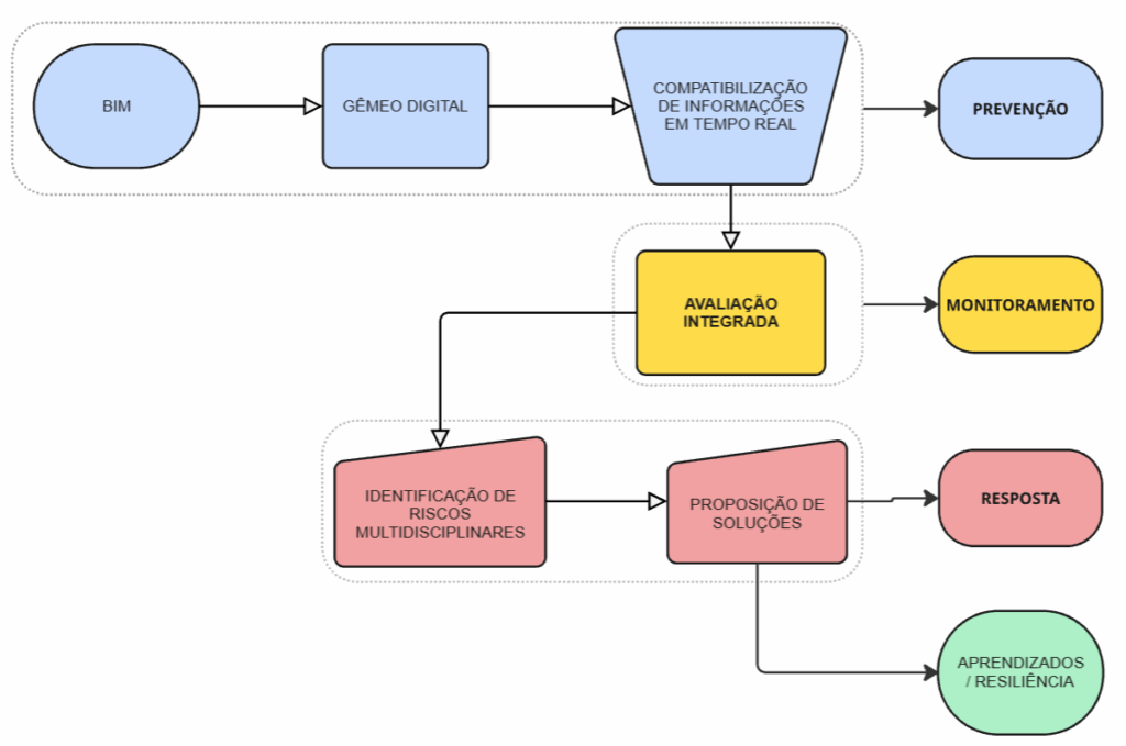
THE BIM is more than a 3D modeling tool: it is a information management system that integrates all disciplines of a project in a federated model.
In geotechnics, BIM enables:
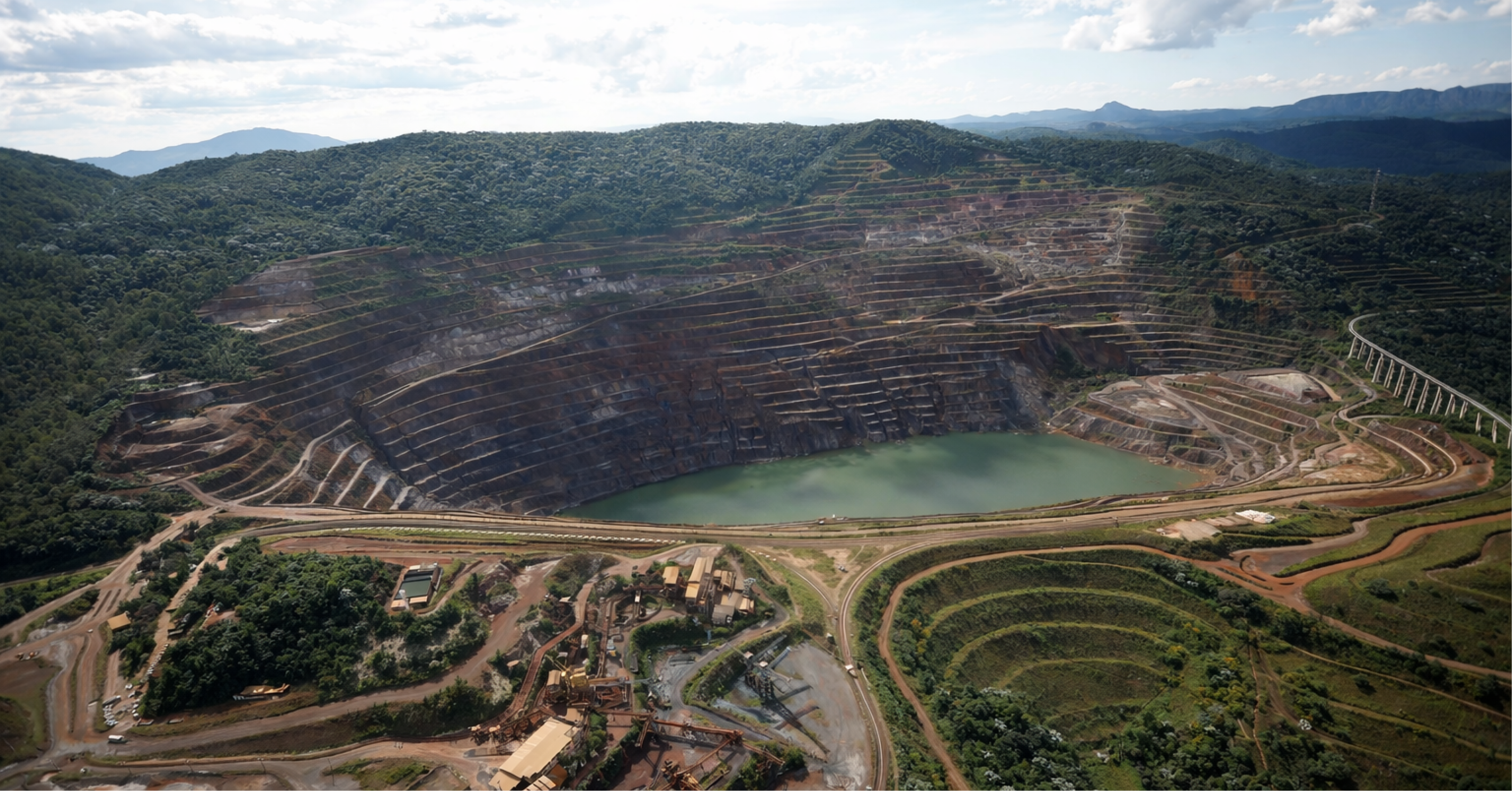
- Multidisciplinary integration: geology, topography, hydrology, drainage hydraulics and slope stability in a single digital environment.
- Preliminary simulation of critical scenarios: rising water levels in pits, erosion in piles and slopes, pore pressures in dams, piles and slopes.
- Reduction of uncertainties: association of geotechnical tests (SPT, CPTu, triaxial tests, permeability) directly to the model.
This ability to centralize and correlate information transforms BIM into a engineering instrument, in which risks can be identified and mitigated during the project design phase.
From BIM to Digital Twin: from design to operation
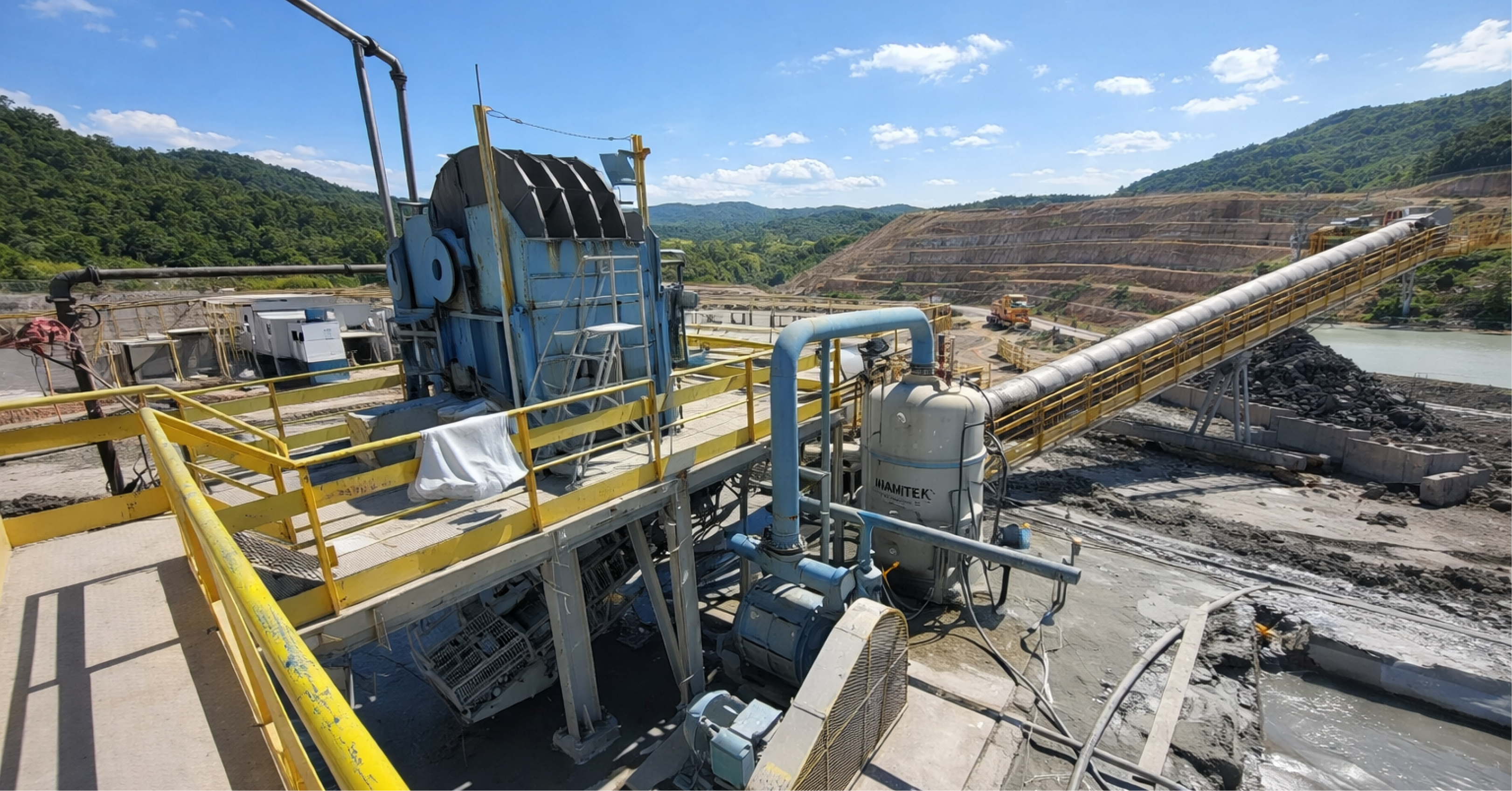
While BIM represents the digital project, the Digital Twin is the living counterpart of the physical structureIt integrates, in near real time, information from monitoring systems, such as:
- Piezometers and inclinometers: measurement of pore pressures, water levels and deformations in dams and slopes.
- InSAR and LiDAR Radar: remote detection of millimeter displacements in waste piles and pits.
- Rain gauges and hydrometeorological stations: correlation between extreme rainfall events and structural response.
By consolidating this data into the digital model, a platform is created capable of:
- Compare actual vs. projected performance, allowing deviations to be identified.
- Anticipate instability scenarios, through simulations and numerical analyses linked to field readings.
- Activate contingency plans based on objective indicators, reducing exposure to catastrophic failures.
Thus, Digital Twins represent an advancement in geotechnical engineering towards a logic of adaptive and resilient management, in which each monitored event feeds back and strengthens the system.
Digital Governance and Risk Management
The true value of these technologies lies in their association with internationally recognized risk management, which guarantees not only technical efficiency, but also regulatory compliance and organizational transparency:
- RIDM (Risk-Informed Decision Making): decisions driven by data from the digital model, reducing subjectivity.
- ISO 31000: integration of climate, geotechnical and operational risks into the life cycle of structures.
- GISTM (Global Industry Standard on Tailings Management): incorporation of extreme precipitation scenarios and hydrological events into planning.
With digital dashboards derived from BIM and Digital Twins, governance is strengthened with dynamic reports that can be shared with managers, regulatory bodies and communities, increasing technical security, transparency and public trust.
Resilience applied to geotechnics
The concept of resilience, widely discussed in risk engineering, means the ability to absorb, respond quickly and adapt to new scenarios proposed especially for climatic and/or unforeseen issues.
With BIM and Digital Twins, resilience is built into all phases of the project:
- Project: analysis of extreme hydrological load scenarios and multidisciplinary compatibility.
- Construction: digital monitoring of execution, minimizing deviations from the project.
- Operation: continuous monitoring that allows rapid response to anomalies, reducing the time of exposure to risks.
- Closing: Digital models preserve the historical behavior of structures, supporting rehabilitation strategies and post-closure monitoring.
This approach places geotechnics on a higher level proactive, moving from just reacting to failures to anticipating them.
Thus, the future of geotechnical engineering involves integration between digitalization and geotechnical engineering. BIM and Digital Twins are not just technological tools: they are risk management strategies and resilience building, which reduce uncertainties, increase project reliability and strengthen the sustainability of operations.
For companies in the mining sector, adopting this vision is synonymous with competitive advantage: safer, more efficient operations aligned with international best practices (ICOLD, GISTM, ISO 31000).
VinQ Geotechnics positions itself as a strategic partner for companies seeking operational safety, sustainability, and competitive advantage. Our role goes beyond conventional consulting: we perform integrated information management on BIM platforms and develop our projects from conception to comprehensive information management models, ensuring consistency, traceability, and compatibility throughout all phases.
With this approach, we integrate preventive engineering, digital management, and a systemic view of risks, transforming data into knowledge, knowledge into decisions, and decisions into safer and more resilient structures.
Thus, we reaffirm our commitment to being at the forefront of the digital transformation of geotechnics, offering solutions that combine technical excellence, innovation and socio-environmental responsibility, aligned with the best global practices (ICOLD, GISTM, ISO 31000).
Authors:

Matheus Vicentini
Civil Engineer (Unilavras), Specialist in Geotechnical Engineering (PUC Minas).
Civil Engineer with experience in geotechnics applied to mining, with experience in projects, audits and dam decommissioning works.

Leandro Azevedo da Silva
Bachelor in Geology (UFRRJ), Master in Mining Engineering (UFMG) and Specialist in Mineral Resources Engineering.
A geologist with nearly 20 years of experience in geotechnics, he leads technical projects at VINQ, combining innovation and safety in mining solutions.